Log in
All resources
Create a design
452 Free Artworks of 1860 Maps
gemeente atlas van nederland - south holland
1860s maps of south holland
gemeente atlas van nederland - north holland
1860s maps of north holland
19th-century maps of rotterdam
media from regionaal archief alkmaar
maps of polders in south holland
molenlanden in the 1860s
rotterdam in the 1860s
netherlands in the 1860s
gemeente atlas van nederland - south holland
1860s maps of south holland
maps of nieuwpoort, south-holland
vestingwerken nieuwpoort
media from the national library of finland
classicism
gemeente atlas van nederland - south holland
1860s maps of south holland
gemeente atlas van nederland - south holland
old maps of the hague
gemeente atlas van nederland - south holland
19th-century maps of rotterdam
admiralty charts 2601-2800
tralee
gemeente atlas van nederland - south holland
maps of zuidland
gemeente atlas van nederland - south holland
19th-century maps of rotterdam
gemeente atlas van nederland - south holland
1860s maps of south holland
maps in the rijksmuseum amsterdam
published by frans buffa & zonen
maps in the rijksmuseum amsterdam
published by frans buffa & zonen
kaart van suriname naar opmetingen gedaan in de jaren 1860-1879
albina, suriname
1860s maps of new york (state)
maps showing 1776
gemeente atlas van nederland - south holland
old maps of katwijk, south holland
gemeente atlas van nederland - south holland
maps of groot-ammers
gemeente atlas van nederland - south holland
1860s maps of south holland
gemeente atlas van nederland - south holland
maps of wateringen
gemeente atlas van nederland - south holland
1860s maps of south holland
crystal palace in sydenham
1860s maps of london
history of yokohama
maps of yokohama
19th-century maps of the ottoman empire
maps in the british museum
gemeente atlas van nederland - south holland
maps of alblasserdam
gemeente atlas van nederland - south holland
old maps of brielle
gemeente atlas van nederland - south holland
maps of hellevoetsluis
gemeente atlas van nederland - south holland
1860s maps of south holland
gemeente atlas van nederland - south holland
maps of 's-gravenzande
gemeente atlas van nederland - south holland
old maps of dordrecht
gemeente atlas van nederland - south holland
old maps of gorinchem
gemeente atlas van nederland - south holland
maps of maassluis
gemeente atlas van nederland - south holland
19th-century maps of rotterdam
gemeente atlas van nederland - south holland
19th-century maps of rotterdam
gemeente atlas van nederland - north holland
maps of diemen
gemeente atlas van nederland - south holland
19th-century maps of rotterdam
gemeente atlas van nederland - south holland
1860s maps of south holland
gemeente atlas van nederland - south holland
1860s maps of south holland
gemeente atlas van nederland - south holland
1860s maps of south holland
gemeente atlas van nederland - south holland
1860s maps of south holland
1860 valentine map of new york city
george hayward
gemeente atlas van nederland - south holland
maps of heenvliet
gemeente atlas van nederland - gelderland
netherlands in the 1860s
gemeente atlas van nederland - north holland
old maps of beverwijk
gemeente atlas van nederland - south holland
1860s maps of south holland
gemeente atlas van nederland - south holland
1860s maps of south holland
gemeente atlas van nederland - south holland
1860s maps of south holland
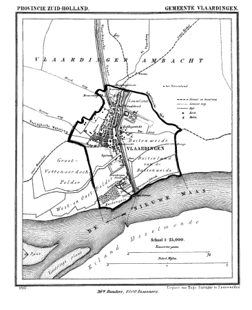
gemeente atlas van nederland - south holland
old maps of vlaardingen
gemeente atlas van nederland - south holland
1860s maps of south holland
gemeente atlas van nederland - south holland
1860s maps of south holland
dutch baroque architecture
old maps of amsterdam
gemeente atlas van nederland - south holland
1860s maps of south holland
chicago and the midwest, newberry library
cartographic reliefs
gemeente atlas van nederland - north holland
old maps of haarlem
gemeente atlas van nederland - north holland
19th-century maps of den helder
gemeente atlas van nederland - south holland
1860s maps of south holland
gemeente atlas van nederland - south holland
1860s maps of south holland
1860 valentine map of new york city
george hayward
gemeente atlas van nederland - south holland
1860s maps of south holland
portrait paintings by michele gordigiani
scapigliatura
gemeente atlas van nederland - south holland
1860s maps of south holland
gemeente atlas van nederland - south holland
1860s maps of south holland
gemeente atlas van nederland - south holland
maps of heerjansdam
gemeente atlas van nederland - south holland
1860s maps of south holland
gemeente atlas van nederland - south holland
1860s maps of south holland
gemeente atlas van nederland - south holland
old maps of eiland van dordrecht
gemeente atlas van nederland - north holland
1860s maps of north holland
gemeente atlas van nederland - south holland
maps of ameide
gemeente atlas van nederland - south holland
1860s maps of south holland
gemeente atlas van nederland - south holland
1860s maps of south holland
gemeente atlas van nederland - north holland
maps of schermer
gemeente atlas van nederland - south holland
maps of haastrecht
gemeente atlas van nederland - south holland
1860s maps of south holland
gemeente atlas van nederland - south holland
strevelshoek
gemeente atlas van nederland - south holland
1860s maps of south holland
gemeente atlas van nederland - south holland
maps of hendrik-ido-ambacht
gemeente atlas van nederland - south holland
1860s maps of south holland
gemeente atlas van nederland - south holland
1860s maps of south holland
gemeente atlas van nederland - south holland
1860s maps of south holland
hamburger stadtentwässerung
1864 maps of hamburg
media from regionaal archief alkmaar
maps of texel
media from regionaal archief alkmaar
old maps of koedijk
gemeente atlas van nederland - north holland
maps of bergen, north holland
media from regionaal archief alkmaar
maps of wieringen
gemeente atlas van nederland - south holland
1860s maps of south holland
gemeente atlas van nederland - south holland
maps of nieuwenhoorn
gemeente atlas van nederland - north holland
19th-century maps of amsterdam
gemeente atlas van nederland - south holland
1860s maps of south holland
media from regionaal archief alkmaar
maps of heerhugowaard
media from regionaal archief alkmaar
maps of wieringerwaard
books published in saint petersburg
boris andreevich dorn
hakodate city central library
maps by takeshiro matsuura
media from regionaal archief alkmaar
maps of heiloo
gemeente atlas van nederland - north holland
maps of beemster
gemeente atlas van nederland - south holland
maps of krimpen aan de lek
gemeente atlas van nederland - north holland
old maps of amsterdam
gemeente atlas van nederland - south holland
1860s maps of south holland
gemeente atlas van nederland - south holland
1860s maps of south holland
gemeente atlas van nederland - south holland
old maps of brielle
gemeente atlas van nederland - south holland
giessen (river south-holland)
gemeente atlas van nederland - south holland
maps of lisse
gemeente atlas van nederland - south holland
1860s maps of south holland
101 - 200 of 452
Next page
/ 5